HISTORY, CIVICS AND GEOGRAPHY Paper 2 (Geography) - 2007 (Two Hours)
Show / Hide Top Details
Answers to this Paper must be written on the paper provided separately. You will not be allowed to write during the first I 5 minutes. This time is to be spent in reading the question paper. The time given at the head of this Paper is the time allowed for writing the answers
Attempt seven questions in all.
Part I is compulsory. Allquestions from Part I are to be attempted.
A total of five questions are to be attempted from Part II:three questions from Section 1 and two questions from Section 2. The intended marks for questions or parts of questions are given in brackets [].
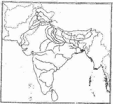
To be supplied with this Paper: Survey of India Map Sheet No. 45D/7
and 20 cm of twine.
Note:-
(i) In all Map Work, by a wise use of arrows to indicate positions of countries, cities and other insertions that you make, you will be able to avoid over crowding parts of the map. (ii) The extract of Survey of India Map Sheet No. 45D/ 7 must not be taken out of the examination hall. It must be handed over to the Supervising Examiner on the completion of the Paper. (iii) The Map given at the end of this question paper must be fastened with your answer booklet. (iv) All sub - sections of each question must be answered in the correct order. (v) All working including rough work, should be done on the same answer sheet as the rest of the answer.
(a) Give the six figure grid reference of :- (i) Δ364
[1]
Answer:Answer:
(Contributed by : x0097251)
(a) Give the six figure grid reference of :- (ii) The temple at Rampura.
[1]
Answer:Answer:
(Contributed by : x0097251)
(b) Mention any two features seen in the map extract which show that the region has seasonal rainfall.
[2]
Answer:Answer:
(Contributed by : x0097251)
(c) Calculate the distance in kilometers along the cart - track linking Juvol (923826) and Arniwada (944817).
[2]
Answer:Answer:
(Contributed by : x0097251)
(d) Which is the chief form of irrigation shown in the map extract? Give an evidence to justify your answer.
[2]
Answer:Answer:
(Contributed by : x0097251)
(e) Give one reason to explain why the streams in grid square 9478 do not join a river. Identify another grid square in the map extract that has similar streams.
[2]
Answer:Answer:
(Contributed by : x0097251)
(f) What do this represent:- (i) Black broken lines in 9575.
[1]
Answer:Answer:
(Contributed by : x0097251)
(f) What do this represent:- (ii) Black curved lines in 9879.
[1]
Answer:Answer:
(Contributed by : x0097251)
(g) Identify two landforms shown by the contours in grid square 9876.
[2]
Answer:Answer:
(Contributed by : x0097251)
(h) (i) What is the general direction of the Balaram Nadi?
[1]
Answer:Answer:
(Contributed by : x0097251)
(h)(ii) Which bank of the main river does the Balaram Nadi join?
[1]
Answer:Answer:
(Contributed by : x0097251)
(i) What is the main occupation of the people living in the area shown in the map extract? Give one reason to support your answer.
[2]
Answer:Answer:
(Contributed by : x0097251)
(j) What is meant by scale of a map? What is the scale of the map extract provided to you?
[2]
Answer:Answer:
(Contributed by : x0097251)
Question 2 On the outline map provided:-
(a) Shade and label the country Nepal.
[1]
Answer:Answer:
(b) Shade and label an area of black soil in India.
[1]
Answer:Answer:
(c) Mark and label the Konkan Coast.
[1]
Answer:Answer:
(d) Shade and label one region of winter rainfall in India.
[1]
Answer:Answer:
(e) Shade and label the Sulaiman Ranges.
[1]
Answer:Answer:
(f) Label the River Yamuna.
[1]
Answer:Answer:
(g) Mark and name the port city of Bangladesh.
[1]
Answer:Answer:
(h) Label the River Tapti.
[1]
Answer:Answer:
(i) Shade and label the Vindhya Ranges.
[1]
Answer:Answer:
(j) Mark and name the capital of Bhutan.
[1]
Answer:Answer:
PART II (50 Marks) SECTION 1 Attempt any three questions from this Section.
Question 3
(a) Name the source of the river Ganga. Where does this river enter the plains?
[2]
Answer:Answer:
(Contributed by : x0097251)
(b) What is a Delta? Name two deltas in South Asia.
[2]
Answer:Answer:
(Contributed by : abhishekindurkar)
(c) State three reasons for the importance of the Peninsular Plateau.
[3]
Answer:Answer:
(Contributed by : abhishekindurkar)
(d) State three reasons why Myanmar and Afghanistan can be considered extensions of South Asia.
[3]
Answer:Answer:
1) They also get rainfall from the same winds from which we get rainfall.
2) They also share a common culture
3) They too were under the british rule
(Contributed by : nvabhishek11)
Question 4
(a) Name the countries that have a land border with Bangladesh.
[2]
Answer:Answer:
(Contributed by : slsharanya)
(b) State two ways in which the rivers of Pakistan are useful to the people of the country.
[2]
Answer:Answer:
it is useful as:-
1)it is the onli perennial source of water for pakistan and for irrigation..
2) it deposits silt and makes a very fertile plain which is good for agriculture..
3)helps in navigation
(Contributed by : gauravshah10)
(c) Mention three differences between the Western Himalayas and Eastern Himalayas.
[3]
Answer:Answer:
(d) Define:-(i) Archipelago
[1]
Answer:Answer:
(Contributed by : saraswati23)
(d) Define:-(ii) Lagoon
[1]
Answer:Answer:
(Contributed by : saraswati23)
(d) Define:-(iii) A land - locked country.
[1]
Answer:Answer:
(Contributed by : slsharanya)
Question 5
(a) Explain two factors that influence the climate of South Asia.
[2]
Answer:Answer:
(Contributed by : saraswati23)
(b) Which type of climate is experienced in the Northern Plains of India? State one main characteristic of this type of climate.
[2]
Answer:Answer:
(Contributed by : haroonaman)
(c) Give a reason for :-(i) Most of Sri Lanka has the Equatorial type of climate.
[1]
Answer:Answer:
(c) Give a reason for :-(ii) Parts of Nepal experience the Arctic type of climate.
[1]
Answer:Answer:
(Contributed by : gauravshah10)
(c) Give a reason for :-(iii) Western coastal plains receive more rainfall than the Eastern coastal plains.
[1]
Answer:Answer:
(Contributed by : saraswati23)
(d) Given below is the climatic data of a station. Study the table and answer the questions that follow:-
Month
J
F
M
A
M
J
J
A
S
O
N
D
Temperature in Degree C.
13.7
16.6
21.6
25.5
33.2
33.5
30.8
29.8
29.2
25.5
19.6
15.2
Rainfall in cms.
2.5
2.0
1.5
0.9
1.5
7.5
17.8
18.5
12.5
1.0
0.2
1.5
(i) Calculate the annual range of temperature.
[1]
Answer:Answer:
(Contributed by : sanjana82)
(d)(ii) What is the total rainfall experienced by the station?
[1]
Answer:Answer:
(Contributed by : sanjana82)
(d)(iii) Which is the driest month?
[1]
Answer:Answer:
(Contributed by : sanjana82)
Question 6
(a) Mention two important characteristics of laterite soil.
[2]
Answer:Answer:
(Contributed by : haroonaman)
(b) Name an area of black soil in India. Mention two crops grown in this soil.
[2]
Answer:Answer:
(Contributed by : haroonaman)
(c) How is alluvial soil formed? Why is this soil agriculturally important?
[3]
Answer:Answer:
(Contributed by : haroonaman)
(d) Name two important agents of erosion. For each, state one method of controlling the erosion caused.
[3]
Answer:Answer:
(i)Wind erosion- One method of controlling wind erosion is by planting many tall trees like coconut trees around open fields which intercept the wind and thus prevent wind erosion.
(ii)Water erosion- Water erosion can be prevented by using less water, traditional water harvesting methods like the construction of johads.
(Contributed by : haroonaman)
Question 7
(a) (i) Name the different types of iron ore found in India.
[1]
Answer:Answer:
(i) Haematite.
(ii)Magnetite.
(ii)Limonite
(Contributed by : haroonaman)
(a)(ii) Mention one place in Nepal where iron ore is found.
[1]
Answer:Answer:
(Contributed by : alokrajiv)
(b) Name an important coal producing State in India and a coal - mine located in that State.
[2]
Answer:Answer:
(Contributed by : haroonaman)
(c) Name two regions in Pakistan where petroleum is found. Which is the largest petroleum producing country in South Asia?
[3]
Answer:Answer:
(Contributed by : haroonaman)
(d) Name an area of limestone in Sri Lanka. Mention two uses of limestone.
[3]
Answer:Answer:
(Contributed by : alokrajiv)
SECTION 2
Attempt any two questions from this Section.
Question 8
(a) Mention two differences between subsistence agriculture and commercial agriculture.
[2]
Answer:Answer:
(i) In subsistence agriculture the farmer grows the plant only to sustain the family whereas in commercial agriculture the farmers grow the plants only to get a benefit by selling it.
(ii) The subsistence method involves the use of traditional seeds whereas in commercial method the farmers use HYV seeds and use abundant water and minerals.
(Contributed by : haroonaman)
(b) State two geographical requirements for the growth of rubber.
[2]
Answer:Answer:
(Contributed by : slsharanya)
(c) In which season is wheat grown in northern India? What are the rainfall and soil requirements of this crop?
[3]
Answer:Answer:
Wheat is a rabi crop and is sown during the months of April and may and harvested in november.Therefore we can conclude that wheat is a winter crop.The wheat crop requires a temperature between 21 & 35 degrees celcius, rainfall of atleast 200-400 cms and requires well drained loamy and laterite soil.
(Contributed by : haroonaman)
(d) Explain why:-(i) Pulses are grown as rotation crops.
[1]
Answer:Answer:
(Contributed by : slsharanya)
(d) Explain why:-(ii) Millets are referred to as dry crops.
[1]
Answer:Answer:
(Contributed by : slsharanya)
(d) Explain why:-(iii) Tea plantations are found on hill slopes.
[1]
Answer:Answer:
(Contributed by : slsharanya)
Question 9
(a) Mention two steps taken by India and Bangladesh to solve the water sharing issues.
[2]
Answer:Answer:
Farrakka Project
Treaty of 1996
(Contributed by : alokrajiv)
(b) How do windmills generate electric power?
[2]
Answer:Answer:
(Contributed by : haroonaman)
(c) Name two main minerals required for generating nuclear energy. Mention the nuclear power stations located in the States of Maharashtra and Tamil Nadu.
[3]
Answer:Answer:
(Contributed by : haroonaman)
(d) (i) Mention two factors that favour the production of Hydel Power in the region around the Western Ghats.
2
Answer:Answer:
(Contributed by : saraswati23)
(d)(ii) State one advantage of electricity over coal.
[3]
Answer:Answer:
No air pollution
(Contributed by : alokrajiv)
Question 10
(a) State two reasons for the concentration of the sugar industry in Uttar Pradesh.
[2]
Answer:Answer:
(i) Sugarcane is produced more in Uttar Pradesh and since sugar industry requires sugarcane as a basic raw material it is also more concentrated in Uttar Pradesh.
(ii) Sugarcane is a heavy and perishable raw material and therefore it has to be crushed within 24 hours else the sucrose content gets reduced and hence the sugar Industry must be close to the sugarcane fields.
(Contributed by : haroonaman)
(b) Mention two ways in which the agro - based industries have affected the economy of India.
[2]
Answer:Answer:
Employ very large number of people
Adds to per capitol income
(Contributed by : alokrajiv)
(c) (i) Which is the largest jute producing State in India? Name two centers of jute industry in that State.
2
Answer:Answer:
(Contributed by : haroonaman)
(c)(ii) Name two jute products.
[3]
Answer:Answer:
(Contributed by : haroonaman)
(d) State three main problems faced by the cotton textile industry in India.
[3]
Answer:Answer:
(i) Scarcity of raw material as after the partition of India many of the long staple cotton producing areas went to Pakistan.
(ii) Most of the cotton mills in India are obsolete and old as they are used for as long as 20-30 years but other developed countries' machineries are made to work only for about 10 years.
(iii) Because of the increasing population, the power consumption is increasing day by day and hence the problem of power supply is becoming acute and the industry suffers from shortage of power.
(Contributed by : haroonaman)
Question 11
(a) Mention two reasons for the concentration of steel plants in the Chota - Nagpur Plateau region.
[2]
Answer:Answer:
Availabilty of raw materials
Availability of coal and other minerals
(Contributed by : alokrajiv)
(b) Name four petrochemical products.
[2]
Answer:Answer:
(Contributed by : haroonaman)
(c) What is the importance of the Heavy Engineering industry for the industrial development of India? Name two Heavy Engineering industrial units in India.
[3]
Answer:Answer:
(d) (i) What are integrated steel plants?
2
Answer:Answer:
(Contributed by : haroonaman)
(d)(ii) Name one integrated steel plant in the Public Sector. From where does this plant get its requirement of iron ore and coal?